.
Extension Requête Spatiale
The  Spatial Query Plugin allows you to make a spatial query
(i.e., select features) in a target layer with reference to another layer. The
functionality is based on the GEOS library and depends on the selected source
feature layer.
Spatial Query Plugin allows you to make a spatial query
(i.e., select features) in a target layer with reference to another layer. The
functionality is based on the GEOS library and depends on the selected source
feature layer.
Les opérateurs disponibles sont :
Contient
Egale
Recouvre
Croise
Intersecte
Est disjoint
Touche
Est à l’intérieur
Mettre en oeuvre l’extension
Nous souhaitons par exemple trouver les régions dans le jeu de données Alaska qui ont des aéroports. Les étapes suivantes sont à effectuer :
- Start QGIS and load the vector layers
regions.shpandairports.shp. - Load the Spatial Query plugin in the Plugin Manager (see
La fenêtre des Extensions) and click on the
Spatial Query icon, which appears in the QGIS toolbar menu. The plugin
dialog appears.
Sélectionnez la couche
régionscomme couche source etaéroportscomme couche de référence.Sélectionnez ‘A l’intérieur’ comme opérateur et cliquez sur [Appliquer].
Vous obtenez alors une liste d’identifiants des entités satisfaisant la requête. Vous avez ensuite plusieurs options comme indiqué en figure figure_spatial_query_1.
- Click on
 Create layer with list of items.
 - Select an ID from the list and click on
 Create layer with selected.
 - Select ‘Remove from current selection’ in the field
And use the result to
 .
. Vous pouvez
 Zoom sur l’objet ou Enregistrer les messages.
- Additionally in Result Feature ID’s with the options ‘Invalid source’ and ‘Invalid reference’ you can have a look at features with geometries errors. These features aren’t used for the query.
Figure Spatial Query 1:
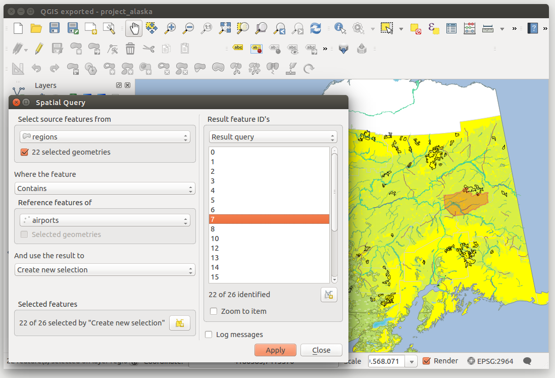
Spatial Query analysis - regions contain airports