Módulo de Consulta Espacial
The  Spatial Query Plugin allows you to make a spatial query
(i.e., select features) in a target layer with reference to another layer. The
functionality is based on the GEOS library and depends on the selected source
feature layer.
Os operadores possíveis são:
Contém
Igual
Sobrepõe-se
Cruza
Instersecta
É separado
Toca
Dentro de
Usando o módulo
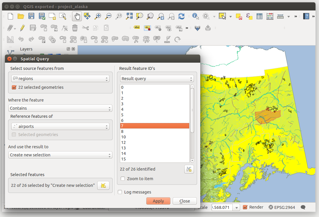
Como exemplo, nós queremos encontrar as regiões no conjunto de dados do Alaska que contém os aeroportos. Os seguintes passos são necessários:
- Start QGIS and load the vector layers
regions.shpandairports.shp. - Load the Spatial Query plugin in the Plugin Manager (see
The Plugins Dialog) and click on the
 Spatial Query icon, which appears in the QGIS toolbar menu. The plugin
dialog appears.
 Seleccione a camada
regionscomo camada fonte eairportscomo camada de elementos referência.Seleccione ‘Contém’ como operador e clique [Aplicar].
Agora obtém uma lista de elementos ID da consulta e tem várias opções como é mostrado na figure_spatial_query_1.
- Click on
 Create layer with list of items.
 - Select an ID from the list and click on
 Create layer with selected.
 - Select ‘Remove from current selection’ in the field
And use the result to
 .
. - You can
 Zoom to item or display
 Log messages.
 - Additionally in Result Feature ID’s with the options ‘Invalid source’ and ‘Invalid reference’ you can have a look at features with geometry errors. These features aren’t used for the query.
Figure Spatial Query 1:

Spatial Query analysis - regions contain airports