Módulo Verificador de Topologia
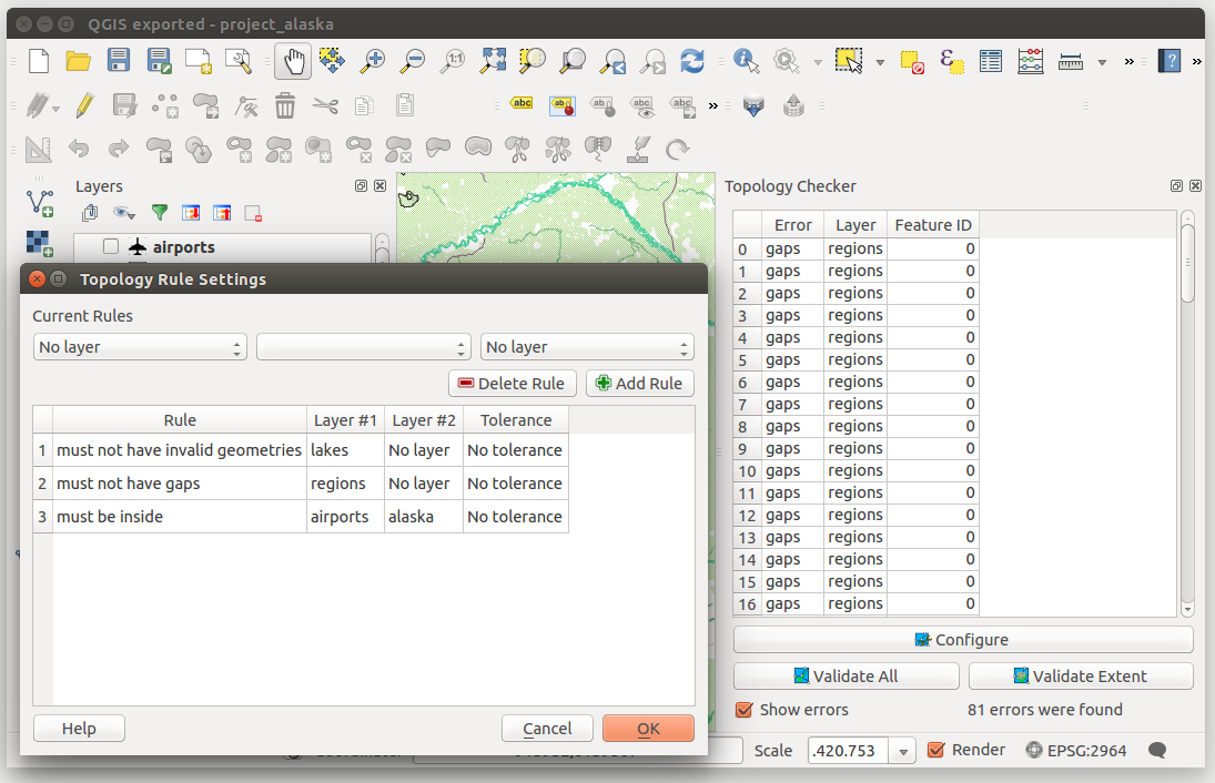
Figure Topology Checker:

O Módulo Verificador de Topologia
A topologia descreve as relações entre pontos, linhas e polígonos que representam elementos de uma região geográfica. Com o módulo Verificador de Topologia pode ver os seus ficheiros vetoriais e verificar a topologia com várias regras topológicas. Estas regras verificam, através de relações espaciais, se qualquer daqueles elementos ‘Iguala’, ‘Contém’, ‘Abrange’, é ‘AbrangidoPor’, ‘Cruza’, é ‘DijuntoDe’, ‘Intersecta’, se ‘SobrepõeA’, ‘Toca’ ou ‘EstáContidoEm’ outro(s) elemento(s). Das suas questões individuais dependerão as regras topológicas a aplicar aos seus dados vetoriais (ex: normalmente não aceitará ultrapassagens na junção de linhas, mas, se aquelas figurarem becos ou ruas sem saída, então já não irá removê-las da sua camada vetorial).
QGIS has a built-in topological editing feature, which is great for creating new features without errors. But existing data errors and user-induced errors are hard to find. This plugin helps you find such errors through a list of rules.
É muito simples para criar regras topológicas com o módulo Verificador de Topologia
Nas camadas do tipo vector as seguintes regras estão disponíveis:
- Must be covered by: Here you can choose a vector layer from your project. Points that aren’t covered by the given vector layer occur in the ‘Error’ field.
- Must be covered by endpoints of: Here you can choose a line layer from your project.
- Must be inside: Here you can choose a polygon layer from your project. The points must be inside a polygon. Otherwise, QGIS writes an ‘Error’ for the point.
- Must not have duplicates: Whenever a point is represented twice or more, it will occur in the ‘Error’ field.
- Must not have invalid geometries: Checks whether the geometries are valid.
- Must not have multi-part-geometries: All multi-part points are written into the ‘Error’ field.
On line layers, the following rules are available:
- End points must be covered by: Here you can select a point layer from your project.
- Must not have dangles: This will show the overshoots in the line layer.
- Must not have duplicates: Whenever a line feature is represented twice or more, it will occur in the ‘Error’ field.
- Must not have invalid geometries: Checks whether the geometries are valid.
- Must not have multi-part geometries: Sometimes, a geometry is actually a collection of simple (single-part) geometries. Such a geometry is called multi-part geometry. If it contains just one type of simple geometry, we call it multi-point, multi-linestring or multi-polygon. All multi-part lines are written into the ‘Error’ field.
- Must not have pseudos: A line geometry’s endpoint should be connected to the endpoints of two other geometries. If the endpoint is connected to only one other geometry’s endpoint, the endpoint is called a pseudo node.
On polygon layers, the following rules are available:
- Must contain: Polygon layer must contain at least one point geometry from the second layer.
- Must not have duplicates: Polygons from the same layer must not have identical geometries. Whenever a polygon feature is represented twice or more it will occur in the ‘Error’ field.
- Must not have gaps: Adjacent polygons should not form gaps between them. Administrative boundaries could be mentioned as an example (US state polygons do not have any gaps between them...).
- Must not have invalid geometries: Checks whether the geometries are valid.
Some of the rules that define a valid geometry are:
Os anéis do polígono devem estar fechados.
Anéis que definem buracos devem estar dentro de anéis que definem os limites exteriores.
Os anéis não se podem intersectar a si mesmo (nem mesmo tocar ou cruzar um no outro).
Os anéis não podem tocar outros anéis, à excepção de um ponto.
- Must not have multi-part geometries: Sometimes, a geometry is actually a collection of simple (single-part) geometries. Such a geometry is called multi-part geometry. If it contains just one type of simple geometry, we call it multi-point, multi-linestring or multi-polygon. For example, a country consisting of multiple islands can be represented as a multi-polygon.
- Must not overlap: Adjacent polygons should not share common area.
- Must not overlap with: Adjacent polygons from one layer should not share common area with polygons from another layer.