2.2. Lesson: Ajout de votre première couche
Nous allons lancer l’application, et créer une carte de base à utiliser pour les exemples et les exercices.
Objectif de cette leçon: Démarrer avec une carte d’exemple.
Note
Before starting this exercise, QGIS must be installed on your computer. Also, you should have downloaded the sample data to use.
Lancez QGIS à partir de son raccourci sur le bureau, depuis le menu, etc., selon la façon dont vous avez configuré son installation.
Note
The screenshots for this course were taken in QGIS 3.4 running on Linux. Depending on your setup, the screens you encounter may well appear somewhat different. However, all the same buttons will still be available, and the instructions will work on any OS. You will need QGIS 3.4 (the latest version at time of writing) to use this course.
Commençons dès maintenant !
2.2.1.  Follow Along: Préparer une carte
Ouvrez QGIS. Vous aurez une carte vierge.
The Data Source Manager dialog allows you to choose the data to load depending on the data type. We’ll use it to load our dataset: click the
 Open Data Source Manager button.
If you can’t find the icon, check that the Data Source Manager toolbar is enabled in the menu.
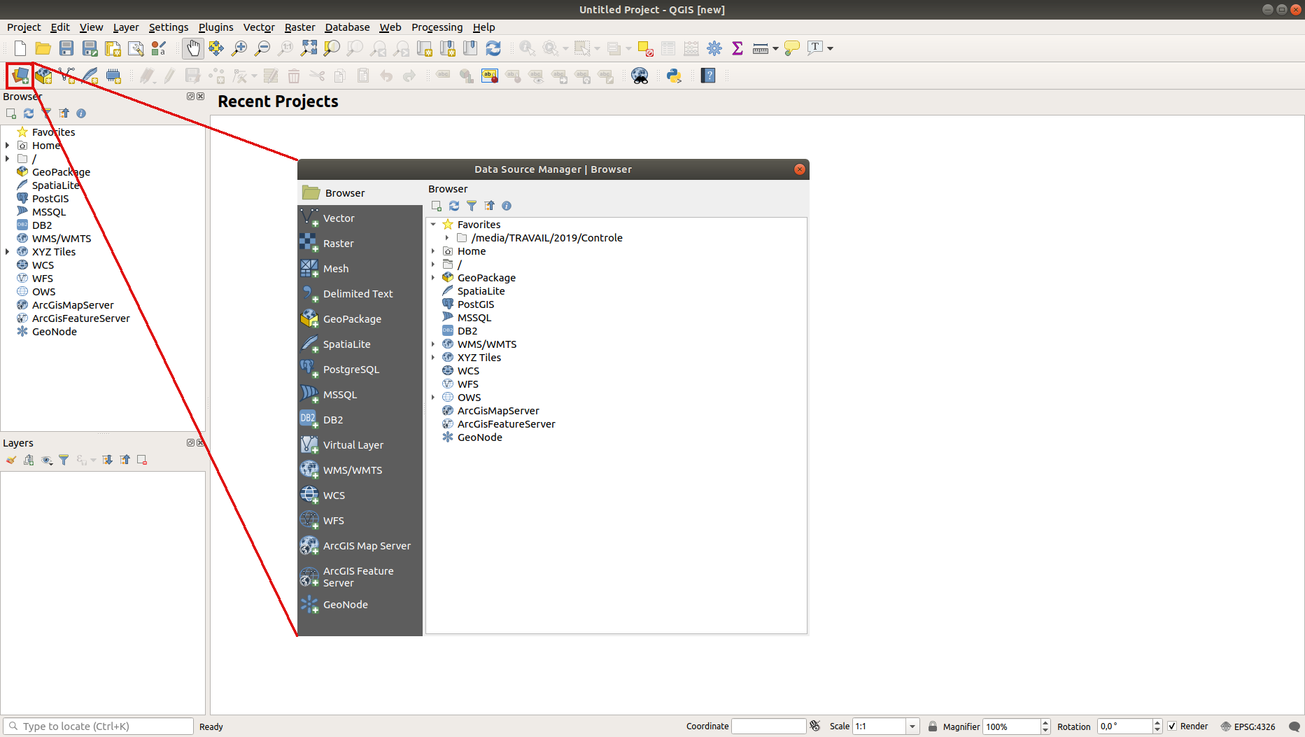
Load the
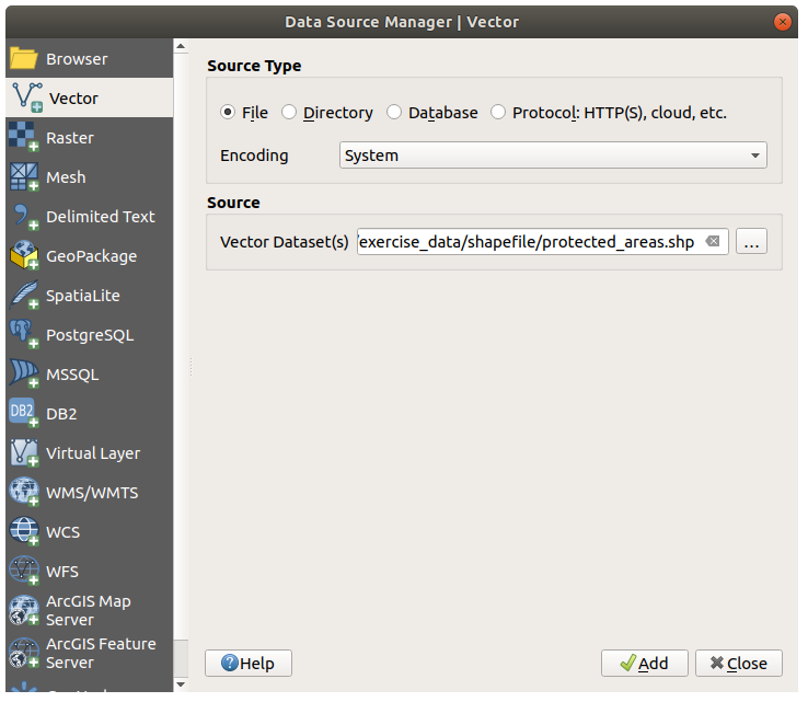
protected_areas.shpvector dataset:Click on the Vector tab.
Enable the
 File source type.
Press the … button next to Vector Dataset(s).
Select the
exercise_data/shapefile/protected_areas.shpfile in your training directory.Click Open. You will see the original dialog, with the file path filled in.
Click Add here as well. The data you specified will now load: you can see a
protected_areasitem in the Layers panel (bottom left) with its features shown in the main map canvas.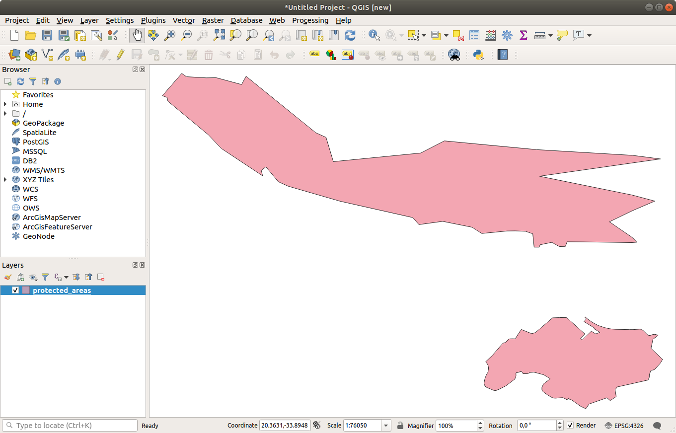
Félicitations ! Vous avez désormais une carte de base. Il est maintenant temps de sauver votre travail.
Cliquez sur le bouton Sauvegarder sous :

Save the map under a
solutionfolder next toexercise_dataand call itbasic_map.qgs.
2.2.2. Try Yourself
Repeat the steps above to add the places.shp and rivers.shp
layers from the same folder (exercise_data/shapefile) to the map.
2.2.3. In Conclusion
You’ve learned how to add a layer from a Shapefile dataset and create a basic map!
2.2.4. What’s Next?
Now you’re familiar with the basic function of the Open Data Source Manager button, but what about all the others? How does this interface work? Before we go on, let’s first take a look at the layout of the QGIS interface. This is the topic of the next lesson.