18.3. Lesson: Working with SpatiaLite databases in QGIS
While PostGIS is generally used on a server to provide spatial database capabilities to multiple users at the same time, QGIS also supports the use of a file format called SpatiaLite that is a lightweight, portable way to store an entire spatial database in a single file. Obviously, these 2 types of spatial databases should be used for different purposes, but the same basic principles and techniques apply to both. Let’s create a new SpatiaLite database and explore the functionality provided to work with these databases in QGIS.
The goal for this lesson: To learn how to interact with SpatiaLite databases using the QGIS Browser interface.
18.3.1.  Follow Along: Creating a SpatiaLite database with the Browser
Using the Browser panel, we can create a new SpatiaLite database and get it setup for use in QGIS.
Right click on the SpatiaLite entry in the Browser tree and select Create Database.
Specify where on your filesystem you want to store the file and name it
qgis-sl.db.Again right click on the SpatiaLite entry in the Browser tree and now select the New Connection item. Find the file you created in the last step and open it.
Adesso che il database é configurato é possibile notare che la voce nell’albero del Browser non ha niente sotto di se e che l’unica cosa che si puó fare a questo punto é cancellare la connessione. Ovviamente questo é dovuto al fatto che nessuna tabella é stata aggiunta al database. Procediamo con questa operazione.
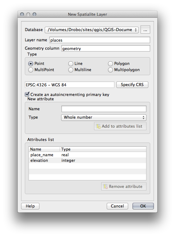
Find the button to create a new layer and use the dropdown to create a new SpatiaLite layer, or select
 .
.Selezionare il database creato in precedenza dal menu a tendina.
Give the layer the name
places.Selezionare la casella di controllo vicino a Create an auto-incrementing primary key.
Add two attributes as shown in below
Click su OK per creare la tabella.
Click the refresh button at the top of the Browser and you should now see your
placestable listed.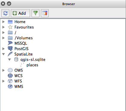
É possibile fare click con il tasto destro sulla tabella e vedere le sue proprietá come giá fatto nell’esercizio precedente.
Da qui é possiile iniziare la sessione di modifica ed aggiungere direttamente dati al nuovo database.
We also learned about how to import data into a database using the DB Manager and you can use this same technique to import data into your new SpatiaLite DB.
18.3.2. In Conclusion
You have seen how to create SpatiaLite databases, add tables to them and use these tables as layers in QGIS.