27.3. Anhang C: QGIS-Dateiformate
27.3.1. QGS/QGZ - Das QGIS-Projekt-Dateiformat
Das QGS-Format ist ein XML-Format zur Speicherung von QGIS-Projekten. Das QGZ-Format ist ein komprimiertes (Zip-)Archiv, das eine QGS-Datei und eine QGD-Datei enthält. Die QGD-Datei ist die zugehörige Sqlite-Datenbank des qgis-Projekts, die Hilfsdaten für das Projekt enthält. Wenn es keine Hilfsdaten gibt, ist die QGD-Datei leer.
A QGIS file contains everything that is needed for storing a QGIS project, including:
project title
project CRS
the layer tree
snapping settings
relations
the map canvas extent
project models
legend
mapview docks (2D and 3D)
the layers with links to the underlying datasets (data sources) and other layer properties including extent, SRS, joins, styles, renderer, blend mode, opacity and more.
project properties
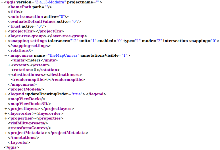
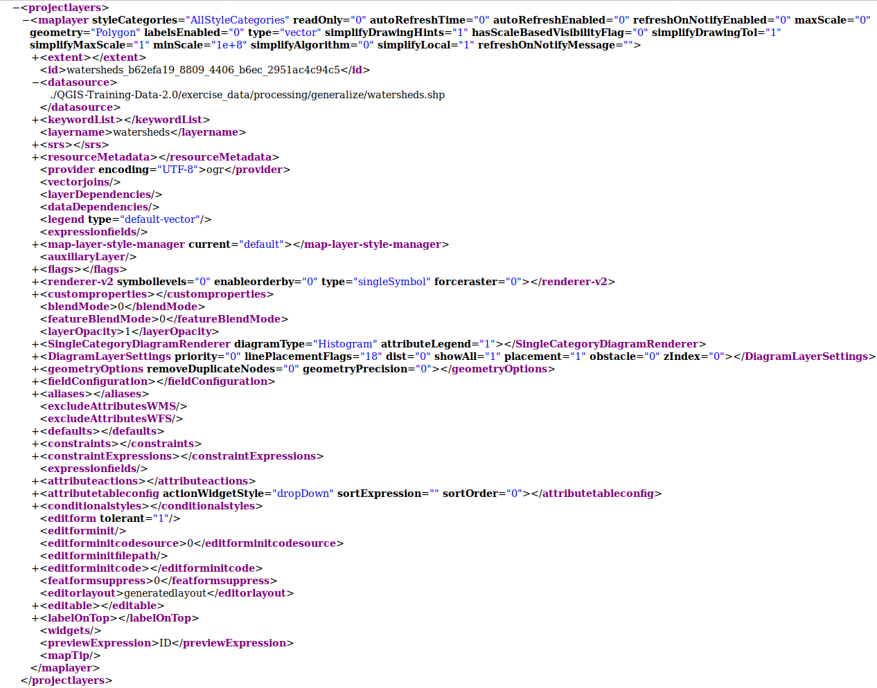
The figures below show the top level tags in a QGS file and the expanded
ProjectLayers tag.

Abb. 27.1 The top level tags in a QGS file

Abb. 27.2 The expanded top level ProjectLayers tag of a QGS file
27.3.2. QLR - The QGIS Layer Definition file
A Layer Definition file (QLR) is an XML file that contains a pointer to the layer data source in addition to QGIS style information for the layer.
The use case for this file is simple: To have a single file for opening a data source and bringing in all the related style information. QLR files also allow you to mask the underlying datasource in an easy to open file.
Ein Beispiel für die Verwendung von QLR ist das Öffnen von MS SQL-Layern. Anstatt den MS SQL-Verbindungsdialog aufrufen, verbinden, auswählen, laden und schließlich stylen zu müssen, können Sie einfach eine .qlr-Datei hinzufügen, die auf den richtigen MS SQL-Layer mit allen erforderlichen Stilen verweist.
In Zukunft kann eine .qlr-Datei einen Verweis auf mehr als eine Ebene enthalten.

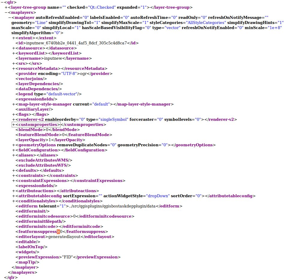
Abb. 27.3 Die Tags der obersten Ebene einer QLR-Datei
27.3.3. QML - Das QGIS-Stil-Dateiformat
QML ist ein XML-Format zum Speichern von Layer-Stilen.
Eine QML-Datei enthält alle Informationen, die QGIS für das Rendern von Feature-Geometrien verarbeiten kann, einschließlich Symboldefinitionen, Größen und Drehungen, Beschriftung, Deckkraft und Mischmodus und mehr.
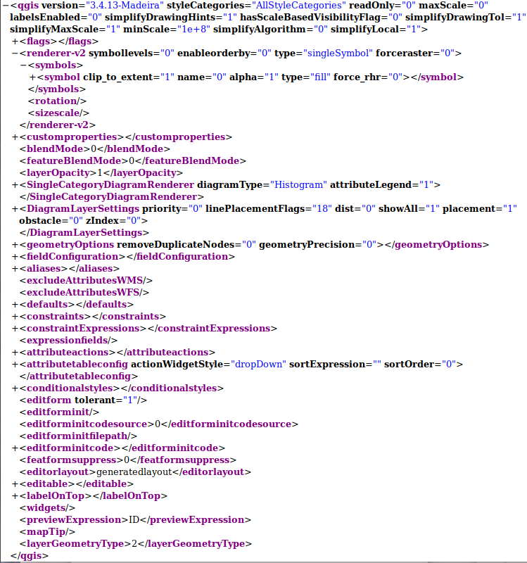
The figure below shows the top level tags of a QML file (with
only renderer_v2 and its symbol tag expanded).

Abb. 27.4 The top level tags of a QML file (only the renderer_v2 tag with its symbol tag is expanded)