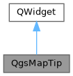
Displays a tool tip on a map canvas when the mouse is hovered over a feature. More...
#include <qgsmaptip.h>

Public Member Functions | |
| QgsMapTip () | |
| Default constructor. | |
| void | clear (QgsMapCanvas *mpMapCanvas=nullptr, int msDelay=0) |
| Clear the current maptip if it exists. | |
| void | showMapTip (QgsMapLayer *thepLayer, QgsPointXY &mapPosition, const QPoint &pixelPosition, QgsMapCanvas *mpMapCanvas) |
| Show a maptip at a given point on the map canvas. | |
Static Public Member Functions | |
| static QString | rasterMapTipPreviewText (QgsMapLayer *layer, QgsMapCanvas *mapCanvas, const QString &mapTemplate) |
| Returns the html that would be displayed in a maptip for a given layer. | |
| static QString | vectorMapTipPreviewText (QgsMapLayer *layer, QgsMapCanvas *mapCanvas, const QString &mapTemplate, const QString &displayExpression) |
| Returns the html that would be displayed in a maptip for a given layer. | |
Detailed Description
Displays a tool tip on a map canvas when the mouse is hovered over a feature.
Since QGIS 2.16 a maptip can show full html. QgsMapTip is a QgsWebView, so you can load full HTML/JS/CSS in it.
The code found in the map tips tab is inserted in a inline-block div so the frame can be resized based on the content size.
If no element in the html has a width attribute, the frame will squeeze down to the widest word. To avoid this you can wrap your HTML in a div style="width:300px" or similar.
JS can be included using the script tag as usual, while CSS files must be linked using link rel="stylesheet" href="URL.css" the html specs discourages link rel="stylesheet" in the body, but all browsers allow it. see https://jakearchibald.com/2016/link-in-body/
Definition at line 51 of file qgsmaptip.h.
Constructor & Destructor Documentation
◆ QgsMapTip()
| QgsMapTip::QgsMapTip | ( | ) |
Default constructor.
Definition at line 78 of file qgsmaptip.cpp.
Member Function Documentation
◆ clear()
| void QgsMapTip::clear | ( | QgsMapCanvas * | mpMapCanvas = nullptr, |
| int | msDelay = 0 |
||
| ) |
Clear the current maptip if it exists.
- Parameters
-
mpMapCanvas the canvas from which the tip should be cleared. msDelay optional time in ms to defer clearing the maptip (since QGIS 3.26)
Definition at line 257 of file qgsmaptip.cpp.
◆ rasterMapTipPreviewText()
|
static |
Returns the html that would be displayed in a maptip for a given layer.
The center pixel of the raster is used to evaluate the expressions.
- Since
- QGIS 3.32
Definition at line 485 of file qgsmaptip.cpp.
◆ showMapTip()
| void QgsMapTip::showMapTip | ( | QgsMapLayer * | thepLayer, |
| QgsPointXY & | mapPosition, | ||
| const QPoint & | pixelPosition, | ||
| QgsMapCanvas * | mpMapCanvas | ||
| ) |
Show a maptip at a given point on the map canvas.
- Parameters
-
thepLayer a qgis vector map layer pointer that will be used to provide the attribute data for the map tip. mapPosition a reference to the position of the cursor in map coordinatess. pixelPosition a reference to the position of the cursor in pixel coordinates. mpMapCanvas a map canvas on which the tip is drawn
Definition at line 87 of file qgsmaptip.cpp.
◆ vectorMapTipPreviewText()
|
static |
Returns the html that would be displayed in a maptip for a given layer.
If the layer has features, the first feature is used to evaluate the expressions.
- Since
- QGIS 3.32
Definition at line 440 of file qgsmaptip.cpp.
The documentation for this class was generated from the following files:
- /build/qgis-3.43.0+git20250405+37eec98dbf6+99sid/src/gui/qgsmaptip.h
- /build/qgis-3.43.0+git20250405+37eec98dbf6+99sid/src/gui/qgsmaptip.cpp